 By Victor Duda
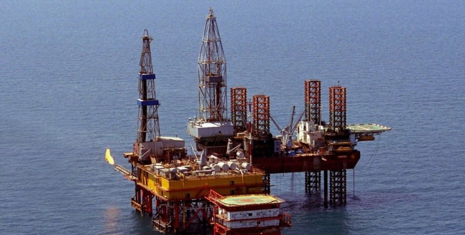
How the ignition point was found, they told at the portal of the Center for Investigation. The portal analyzed a photo of Sentinel-2 satellite, which recorded the condition of the drilling installations for three years of war near the occupied Crimea. The causes of some fires that are burning during a full -scale invasion are a constant leakage of gas from wells. In addition, through hostilities new "hot" points appear - they have noticed analysts.
In particular, in October 2024, another ignition was found in the Black Sea: at point 45. 34494 31. 86363 became hot "Literally Days, October 30". Neither the Ukrainian command nor representatives of the occupying power about any incidents reported, journalists said. The first fire zone is located 50 km from the island of Snake, explained on the portal. "Eternal Fire" was probably first lit after the Armed Forces attack in June 2022.
The Russian authorities then stated that they hit the Tavrida drilling installation. The second zone appeared after the attack in August 2024. Then GUR and Deepstate analysts reported that a marine ice -standing stationary platform (MLSPS) No. 17, on which the Russians installed the remedies, could fire. The third fire zone - 45. 25821, 31. 6735, also appeared in August. The fourth, which was noticed in October, is located 17 km northeast of the third, according to the data of Googla Maps.
There were 14 objects in the Odessa field, of them on four fires for the longest, evidenced by observations. The article contains a collage with points of ignition in the Black Sea. The collage was created on the basis of the satellite data: the pillars of smoke are visible, sometimes something similar to open fire zones. The NASA FIMRS satellite tracking portal can see three large red marks in the Black Sea, which is reported in the investigation.
The archival data shows that these points were fixed by the satellite in October and November. Sometimes there are three, sometimes two or one, sometimes there is no data. It should be noted that in September 2024, GUR fighters told about the special operation conducted in the area. Ukraine destroyed military equipment, which was placed on the towers of the Armed Forces of the Russian Federation.





All rights reserved IN-Ukraine.info - 2022