 By Natali Moss
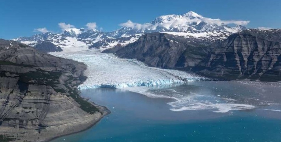
In their work, they used images of seismic research and ground drilling data in Alaska Gulf. As a result, the team revealed the existence of the sixth in the history of the landslide in the Gulf of Alaska. They also managed to restore the topography of the seabed before and after a large -scale event. In focus. Technology has appeared its Telegram channel. Subscribe not to miss the latest and most intrusive news from the world of science! It is expected that a large -scale shift happened about 1.
2 million years ago, and its area was more than 16 square kilometers. Today, the preserved shift volume is only slightly over 9,000 cubic kilometers; Before some parts of the shift were plunged and grown, the volume was 16 280 cubic kilometers. It is known that between 0. 6 and 1. 2 million years ago the glacial-miracle cycle began to extend, and the accumulation and flow of deposits during this period caused the instability of the slopes.
As a result, when a strong earthquake occurred in the region, he probably provoked Megazus. Interestingly, nothing like this has been observed in the region since then, and therefore scientists have tried to find the cause. The team claims that seismic activity in the region is still stored by the soil, but the latter are now much smaller. And there are several reasons.
First, the balance between sedimentary flow and seismic intensification has changed, resulting in underground shocks lead to sealing deposits, which, in turn, improves the sustainability of the slopes. Secondly, icy streams crossing the continental loop are spreading deposits in large slopes, and therefore shifts have become less cohesive. As a result of landslides, the soil is still observed in the region, but they do not reach such catastrophic scales.


 English
 Українська
 USA
USA Français
 Deutsch
 Italiano
 Polski
 Čeština
 Español
 Slovensku